
How National Broadband Ireland’s Game-Changing NBP Rollout Just Shattered Global Expectations—And What It Means for the Future of Connectivity
Ever wonder how you connect more than half a million rural homes to high-speed internet without a hitch—while snagging a global tech award to boot? Well, National Broadband Ireland (NBI) just pulled off that exact feat, and they did it with some seriously savvy technology that’s changing the game on broadband rollout. At the 2026 Esri User Conference in San Diego, NBI nabbed the Special Achievement in GIS Award, beating out a sea of competitors worldwide. What’s behind this success? A smart digital twin called the NBI Build Map, developed by Esri Ireland, which gives real-time insights into infrastructure across 227 deployment areas, helping teams coordinate, troubleshoot, and speed up their work like never before. It’s a reminder that blending cutting-edge tech with solid project management can deliver not just results but groundbreaking efficiency—all while keeping rural Ireland connected and thriving. Ready to dive deeper into how NBI is reshaping digital Ireland? LEARN MORE
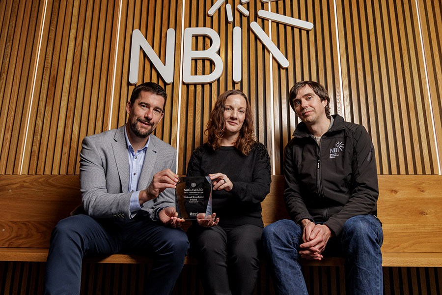
National Broadband Ireland has won a global award for its use of technology to support the rollout of the National Broadband Plan (NBP).
The company won the Special Achievement in GIS (SAG) Awards at the 2026 Esri User Conference in San Diego.
NBI was selected ahead of hundreds of thousands of organisations in recognition of outstanding innovation using GIS technology.
Esri Ireland developed a digital twin that gives NBI visibility of existing and newly installed infrastructure, helping teams coordinate the rollout and make faster decisions.
Known as the NBI Build Map, the digital twin formed a key part of the recognition.
Rolled out over seven years, the National Broadband Plan is the largest telecommunications project ever undertaken by the state, bringing high-speed broadband to 1.1m people in rural areas.
As of the end of October, NBI had passed 543,000 premises, more than the 537,000 premises in the intervention areas when NBI signed its contract with the state.
The NBI Build Map brings together information from all 227 deployment areas, showing the location and status of network infrastructure.
The shared platform supports collaboration between NBI’s specialist teams, its contractors and around 1,200 field workers.
Design contractors use the mapping technology to survey existing infrastructure and check proposed routes, while field teams record completed work, upload photographs and flag issues such as land access constraints.
It gives project managers a real-time view of progress, helps teams resolve problems sooner and gives senior leaders and government stakeholders access to updates without manual reports and meetings.
NBI’s commercial and health and safety teams also use the information to check installations before approving invoices and review whether work has been completed safely.
NBI has integrated Esri’s technology with its ticketing system to create an end-to-end fault management process.
Fault reports are sent automatically through the platform, allowing mobile engineers to receive details, record repairs and close tickets from the field.
The process saves around 45 minutes per ticket, helping teams respond more efficiently to faults, particularly following major storms.
NBI has integrated Esri’s technology with its ticketing system to create an end-to-end fault management process. Fault reports are sent automatically through the platform, allowing mobile engineers to receive details, record repairs and close tickets from the field.
The process saves around 45 minutes per ticket, helping staff to respond more efficiently to faults, particularly following major storms.
“Rural Ireland now has access to a reliable broadband network, enabling equal opportunities for everyone, no matter where they live, work or study,” said Mairead Meyer, chief operations officer at NBI.
“Delivering a project of this scale on time and under budget is unprecedented. It’s fantastic to have that achievement recognised with this global award. It highlights the innovative work and collaboration between the NBI and Esri Ireland teams.”
Padraig Quinn, senior account manager at Esri Ireland, said: “The broadband rollout is a testament to what can be done when technical expertise meets delivery.

“This hugely important project has been expertly executed by the NBI team and we are very proud to have been able to support them with our technology. The Special Achievement in GIS Award, presented at this year’s Esri User Conference, recognises a well-executed project led by a team of truly gifted professionals.
“The NBI team have helped Ireland make tremendous strides in connecting people across the country, no matter how remote their location.”
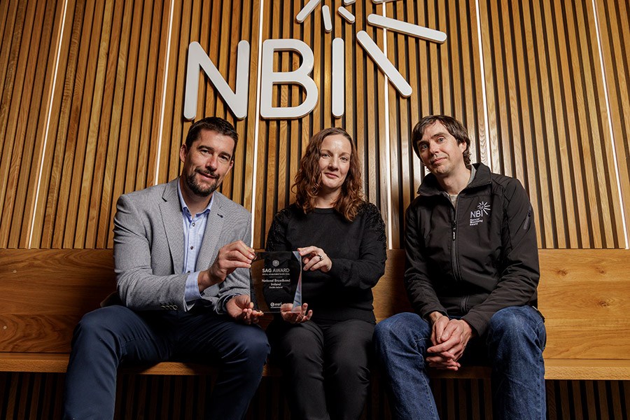
Photo: (l-r) Mairead Meyer, Chief Operations Officer, NBI; Padraig Quinn, Senior Account Manager, Esri Ireland; and Brian O’Malley, Data Specialist Team Manager, NBI. (Pic: supplied)

Organic Banana Bunch (4-5 Count)
(as of November 18, 2026 03:24 GMT +00:00 - More infoProduct prices and availability are accurate as of the date/time indicated and are subject to change. Any price and availability information displayed on [relevant Amazon Site(s), as applicable] at the time of purchase will apply to the purchase of this product.)
JoyGnaw Dog Treats Christmas Advent Calendar 2026 24 Days 6.2 oz | Healthy Natural Dog Chews for All Breeds, Gift Box Surprise, Holiday Countdown, Low Calorie, High Protein, Low Fat
$29.79 (as of November 18, 2026 03:27 GMT +00:00 - More infoProduct prices and availability are accurate as of the date/time indicated and are subject to change. Any price and availability information displayed on [relevant Amazon Site(s), as applicable] at the time of purchase will apply to the purchase of this product.)
Amazon Fire HD 10 tablet, built for relaxation, 10.1" vibrant Full HD screen, octa-core processor, 4 GB RAM, 32 GB, Black
(as of November 18, 2026 03:38 GMT +00:00 - More infoProduct prices and availability are accurate as of the date/time indicated and are subject to change. Any price and availability information displayed on [relevant Amazon Site(s), as applicable] at the time of purchase will apply to the purchase of this product.)
FosPower NOAA Emergency Weather Radio A1 7400mWh Solar Hand Crank (Orange) | AM/FM/WB power bank 4 power options SOS alarm LED flashlight & 4 LED reading light for outdoor emergency & power outage use.
(as of November 18, 2026 03:27 GMT +00:00 - More infoProduct prices and availability are accurate as of the date/time indicated and are subject to change. Any price and availability information displayed on [relevant Amazon Site(s), as applicable] at the time of purchase will apply to the purchase of this product.)













Post Comment